|

| All image products provided by Clear Light Image Products are high resolution, geographically registered degital data. Thus, they can be map projected or combined with vector data, such as place names and borders - either by you or by us.
You can order the image of the area you name, with elevation, bathymetry, and/or sea surface temperature visualization, to achieve more real 3D output, which you can use for movies, for example.
|
|
 |
 |
|
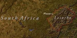
 With place names for maps... With place names for maps...
|
|
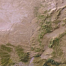
 With elevation data for 3D effects... With elevation data for 3D effects...
|
|
|
|
|
Customized images can be provided in industry-standard formats such as TIFF, JPEG, and EPS. Such image would be ideal for various uses - films, TV programs, GIS and educational software, atlases, textbooks.
|
|
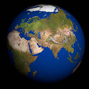 For globes with specified centers... For globes with specified centers... |
 |
|
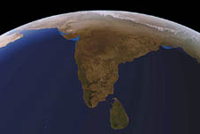
For birds eye views...
|
|
|
The license price depends on the specified area coverage and the use. Please feel free to contact us for questions about our products or a free quote.
|
|
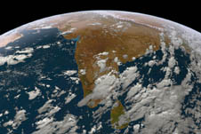 With clouds... With clouds... |
|
|
|