|

Product Name: MISR Earth 278m
(278m resolution true color satellite image) |
|
|
|
|
|
|
|
| zoomed up |
|
 |
|
|
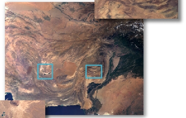
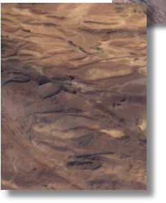
True color image of the earth, obtained from MISR sensor is available in 278m resolution (1 pixel = 278m) and registered to WGS84.
|
|
|
 |
|
| Clear Light has been preparing custom images of the most often requested areas, currently Afghanistan (see the image below), and is in the process of mosaicking those into a world wide coverage. The US, Central Europe, the Middle East, Central Asia, and Western China are primarily complete and the data for the entire Earth between 64 S and 64 N are processed and available for rapid mosaicking on demand. |
|
|
|
|
zoomed up |
|
 |
|
 |
Copyright (c) Jim Knighton
/Clear Light Image Products, 2002 |
|
|
| zoomed up |
|
|
|
 |
|
|
Please name the area you need. Degital data of the image for the whole world or any part of it can be provided in industry-standard formats such as TIFF, JPEG, and EPS. Such image would be ideal for various uses - films, TV programs, GIS and educational software, atlases, textbooks.
The license price is depend on the specified area coverage and the use. Please feel free to contact us for questions about our products or a free quote.
|
|
|
|
|
|
|
|
|
|
|
|
|
|
|
|
|